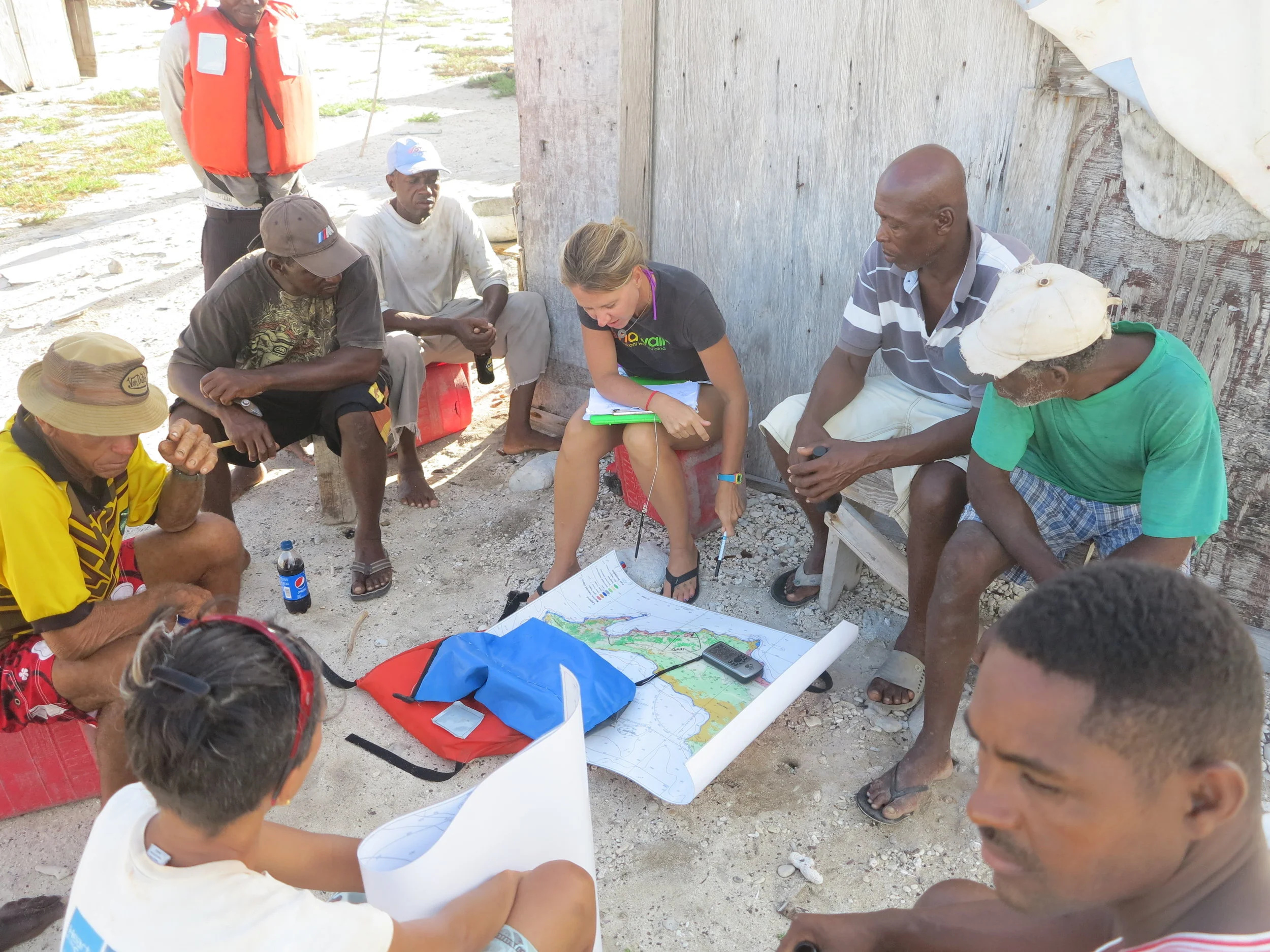
Training courses are tailored to your needs, resources & skill level allowing for an efficient and effective learning environment
LEARN EXACTLY WHAT YOU NEED TO REACH YOUR GOALS FAST
Acquire the basic skills to fly drones safely and legally
I will teach you everything need to know about drones, with both classroom training and hands-on flight skills practice! You will be provided an overview of drone hardware, accessories and software components as well as national policy, regulations and terminology. Learn about flight conduct, safety and emergency operating procedures including performing site evaluations and flight inspections. Once you complete this course, you will have all the knowledge and skills you need to fly safely and confidently to capture great aerial photos and videos with your drone!
Learn how to conduct surveys and create orthomosaic maps and 3D models using your drone
This introductory drone mapping course I will provide the practical skills you need to safely and effectively conduct aerial flight surveys. You will receive an overview of drones and payload sensors, and practical experience using the most popular drone mapping and analysis software available today. Flight planning, site evaluations, equipment inspections and flight logs, as well as drone surveys, mapping and data collection techniques are covered. The skills you acquire will allow you to use your drone to create high-quality 3D orthomosaic and elevation maps from which you can make true-to-scale measurements!
Learn how to monitor your site with advanced drone surveying and mapping techniques
This advanced drone course will allow you to develop, plan and undertake drone mapping and monitoring strategy! Learn how to accurately measure site changes over time – starting from site assessment to flight planning and methods for data collection, creation and management as well as how to share information via web-based platforms. I will also provide you with an overview of the importance of commercial Standard Operating Procedures (SOPs) for your mapping, analysis and reporting workflows to support the production of high quality data your monitoring efforts.
Learn how to capture aerial shots & videos like a pro!
This course will teach you the fundamentals of aerial photography, including how to plan for and capture the best possible shots on every flight! You will learn the basics of your drone’s camera settings, how to conduct automated flights and how to take those ‘iconic’ drone shots you see everywhere! Following this course you will have all the practical skills you’ll need to capture high-quality images and videos with your drone. Need to create promo materials for your organization? I will also introduce you to the best, easy-to-use and freely available, photo and video editing platforms and apps.
Map and monitor crops throughout the growing season
This drone course will focus on key aspects of conducting agricultural drone mapping and monitoring surveys over the growing seasons. You will learn how to design a monitoring site, plan drone surveys and conduct in-field surveys as well as how to process data, create maps, perform spatial analysis, create reports and widely share your agricultural information with ease!
Learn how to build a professional drone operation that’s safe, able to efficiently meet your organization’s needs from the start!
As drone technology continues to advance, it becomes more efficient and cost-effective than ever before. Despite the tremendous benefits, getting started can be confusing and complex. With so many choices of drones, sensors, software etc. available today, it can be difficult to determine how your organization can make the best use of this technology.
I will work with you to identify the most effective solution that is tailored to your applications, skills and budget. We can develop a training program for your team to practically learn how to apply a commercial drone policy, standard operating procedures and data management protocols, so that your team can fly with confidence and quickly provide a return on your investment!
This course introduces Geoinformatics - and how working with spatially-referenced data can provide a better understanding of interactions occurring within the environment. You will learn the five core elements of GIS and how they should be applied to support an ecosystem-based approach. Both theoretical lectures and practical activities (using either ArcGIS and/or Google Earth) will provide you with a solid understanding of how to plan and apply GIS to support your environmental applications. This course is offering can be tailored for any level - from beginner to an advanced deep-dive - based on your needs and resources!
This practical course will teach you how to design for the collection, conversion, and creation of spatial data!
Data is the most important and time consuming part of a` project I will teach you all you the main steps required to conduct a through data needs assessment and inventory. This process will enable you to identify all sources of existing information and begin to populate a geodatabase in which you can store and manage your spatial data. You will also acquire the skills to fill identified data gaps by converting or creating new spatial information.
Guidance for your project is provided each step of the way - from conducting a preliminary needs assessment, followed by planning for data collection and developing mapping methods and data conversion techniques. It doesn’t end there - the importance of managing your data appropriately is an essential, yet often forgotten element to ensure high quality information - so how to efficiently manage and effectively implement data QA/QC procedures will also be covered and practically applied.
Learn how to empower communities to better participate in managing our environment
You’ll learn how environmental monitoring, management and planning initiatives can all benefit from increased community involvement! I will introduce you to the importance of participatory techniques to support the collaborative creation of spatial information. This course provides an overview of my signature PGIS approach, including my methods to effectively map local environmental knowledge as well as how to validate, effectively communicate and share your information to ensure accessibility and understanding across all users.
Learn approaches to problem-solving by exploring spatial patterns, trends and relationships within your GIS data!
This course will explore the importance of spatial analysis and the creation of information using web-mapping analysis platforms and easy to use analytic dashboards and automated reporting tools. You will learn the most commonly applied spatial analysis tools and will gain practical experience performing analysis using (ArcGIS Online, ArcGIS Earth, Google Earth and/or Drone Deploy) web-based mapping analytic tools. If your organization has specific learning needs, feel free to ask me about how we can design a course that meet your specific needs and goals!
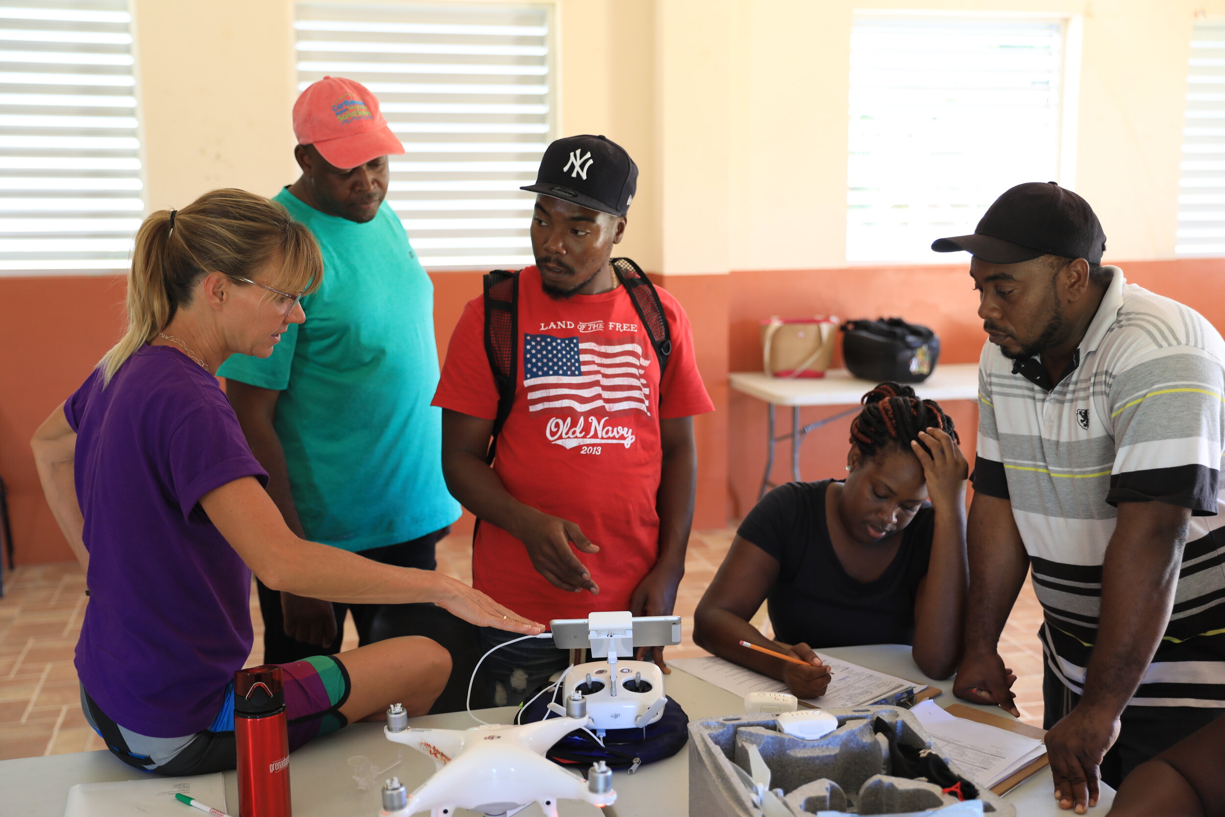
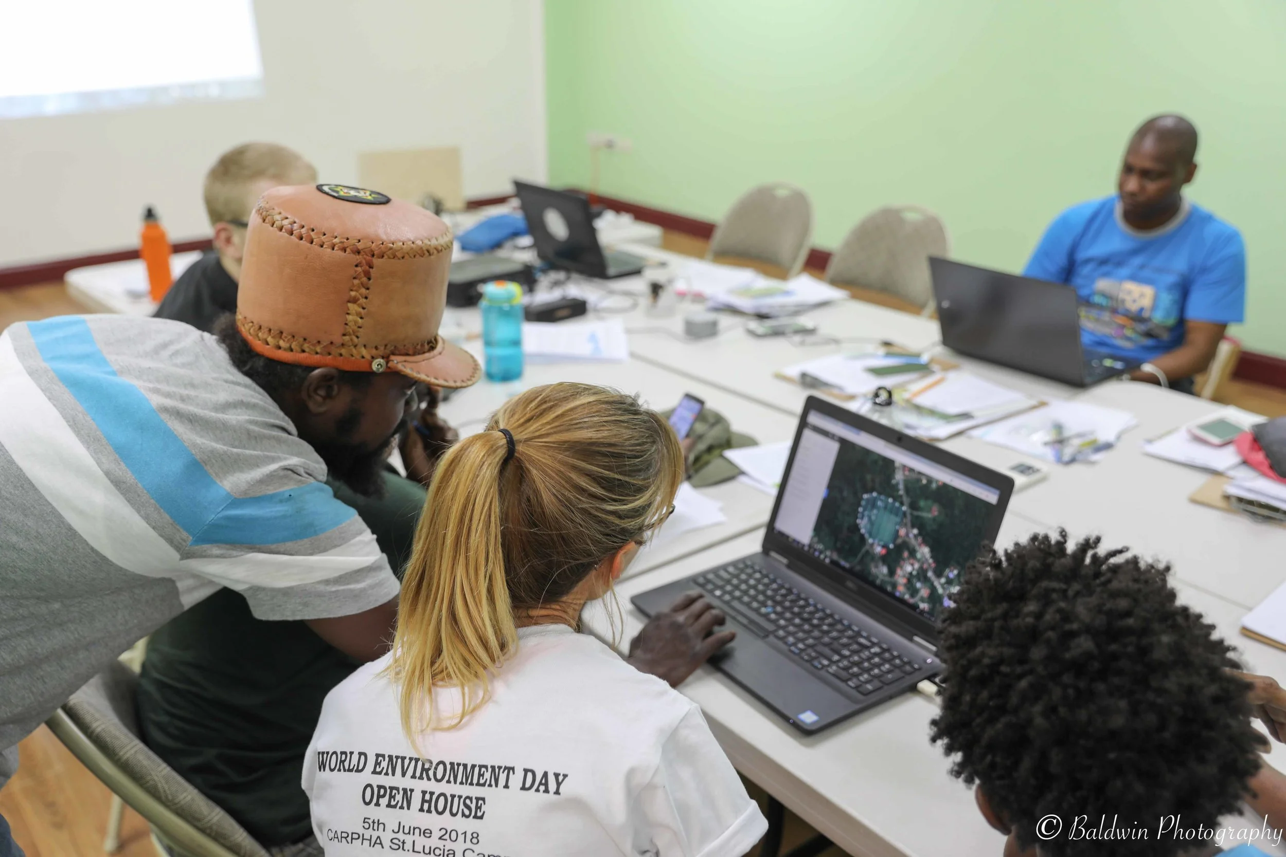
“ Dr. Baldwin was instrumental in developing our Unmanned Aircraft Systems (UAS) Operational Manual and providing training to technicians from a wide range of government and non-government agencies in UAS technology. She also delivered the first comprehensive GIS Data Management Protocol for the Department of Environment’s spatial environmental database. We look forward to collaborating with Kim in the future on other similar initiatives.”